

Your greatest hikes deserve a real printed photo book.
Appalachian Trail, Pacific Crest Trail, Tour du Mont Blanc, or weekend summit hikes. AdvenBook automatically converts your GPS tracks and phone photos into a premium hardcover photo book.
A true publisher-quality book for your treks
No more photos forgotten on your phone. Every trail, every bivouac and every view comes alive in an art-quality layout.
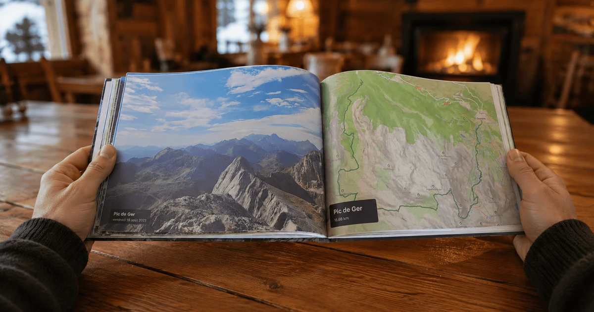
Detailed Topographic Trail Maps
Your recorded GPS tracks are rendered over crisp topographic maps, highlighting every pass, shelter, and summit along the trail.
Elevation Profiles & Trail Stats
Elevation gain, distance, pacing, and highest points: each day's hiking metrics are styled in clear, elegant infographic charts.
Full-Bleed Panoramic Summit Photos
Using timestamps and GPS coordinates from your smartphone or camera, your photos are automatically synchronized to the exact trail segment.
Three formats built for the mountains
From the rugged spiral pocket notebook to the great art book for your shelf.
Soft Spiral Notebook
Opens fully flat through 360°. Ideal for short hikes of 2 to 7 days.
- ✓ 4 to 48 pages
- ✓ Reinforced black metal spiral
- ✓ Glossy laminated cover
- ✓ White coated inner paper
Softcover Book
Art-printer square spine. Ideal for treks of 1 to 3 weeks.
- ✓ 32 to 250 pages
- ✓ Bookshop-finish square spine
- ✓ Custom printed spine
- ✓ Light and easy to browse anywhere
Hardcover Book
Case-bound art book. The lasting record of your greatest achievements.
- ✓ 24 to 400 pages
- ✓ Thick rigid case board
- ✓ Sturdy binding, publisher quality
- ✓ The jewel of your bookshelf
Frequently Asked Questions About Hiking Photo Books
Ready to preserve your mountain memories?
Upload your GPX tracks and preview your complete custom hiking book in minutes.
Start My Hiking Book (Free Preview)The book of your long-distance hike